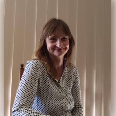
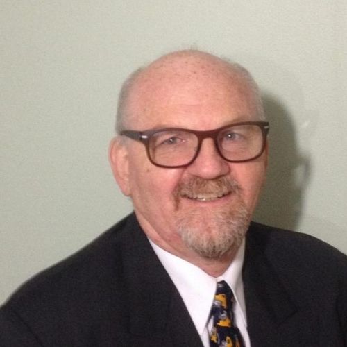
Search
Close this search box.
Search
Close this search box.

Members

Linking community with decision makers

Our members include 9 community, 2 local government and 4 government agency representatives. Members are actively involved in the development of project proposals, establishing priorities for projects and contributing to our strategic direction.

Our community members provide a critical link with the community. They bring community issues to the organisation and disseminate catchment management information back to the community.

We aim to achieve diverse representation of community skills, knowledge and experience on our Board; including indigenous heritage, backgrounds in agriculture, business, community, natural resource management and environmental management.

Agency and local government members provide a link with government and help to integrate community and catchment values into policy and decision making.

Vicky Winton
Chair

Vicky is an archaeologist who moved to Busselton with her teacher husband and young son in 2017. She is a keen gardener, composter and consumer of local produce, with an interest in regenerative farming practices. “GeoCatch sits in the heart of the community. I am excited to work with the talented and hugely experienced board, staff and partners in delivering impactful projects that will continue to improve our environment, community and prospects into the future,” said Vicky.
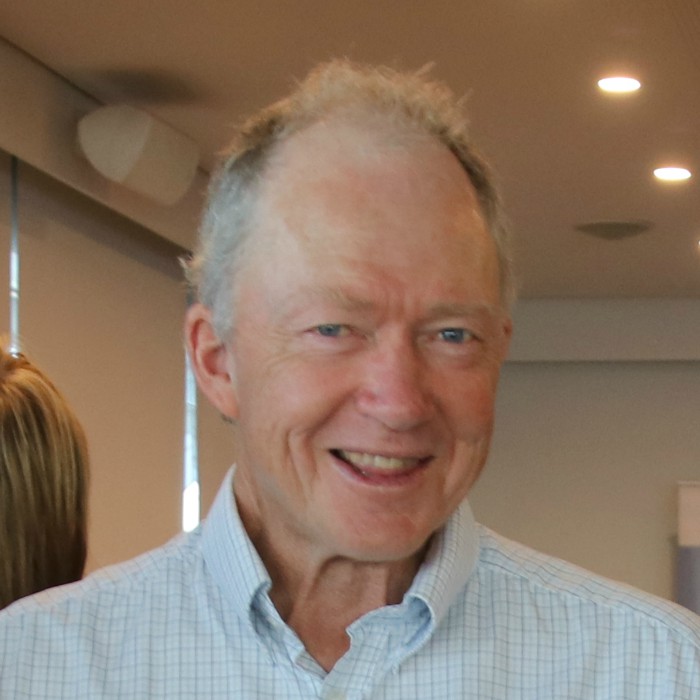
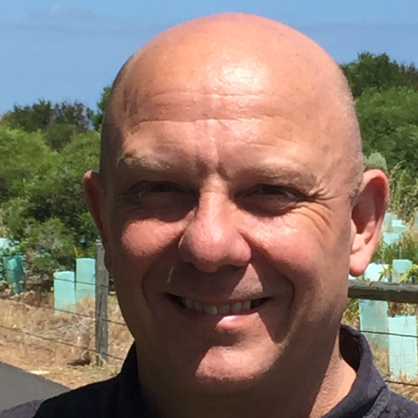
Robin Belford
Deputy Chair

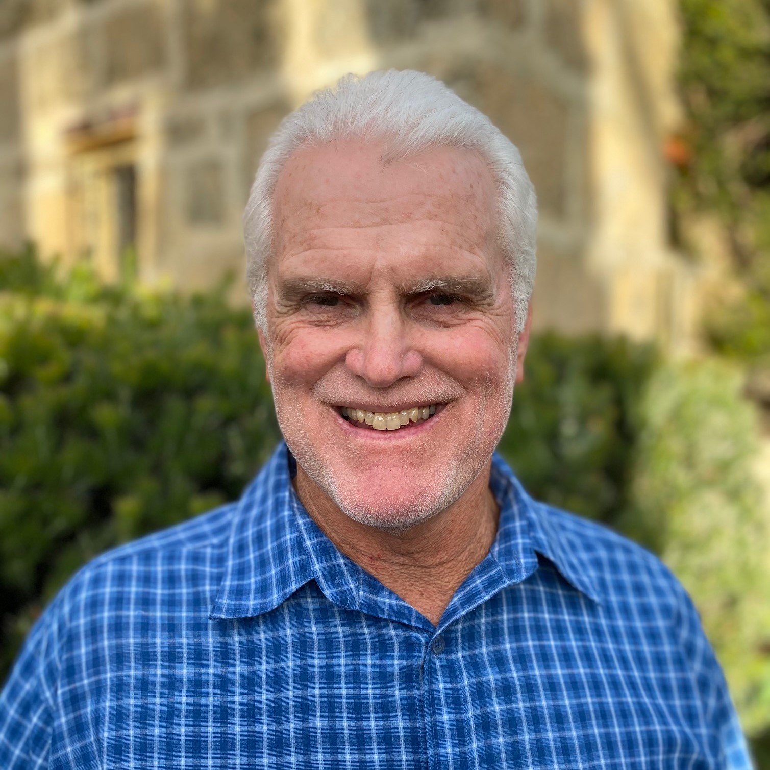
Robin has lived and worked in the Busselton community for over 26 years. A qualified engineer, he has worked for Water Corporation and Busselton Water, and was previously a member of the Vasse Taskforce. Although now retired, he is an active member of the water industry.

Peter Togno
Secretary-Treasurer

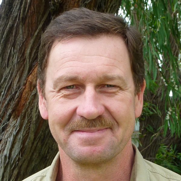
Peter is a retired Organic Dairy farmer of 42 years who now farms 300 acres in Ruabon. Peter has a long affinity for Geographe Bay having sailed out of Geographe Bay Yacht Club for 38 years. His knowledge of sustainable agriculture is an asset to the board of GeoCatch.

Cr Phill Cronin
City of Busselton

Phill is a hobby farmer, communication consultant, Board member, husband and City of Busselton Councillor (Mayor). Originally from the UK where he qualified with a Bachelor of Civil Engineering, Phill has been living in the South West for nearly four years, having been a regular visitor for more than 20 years.
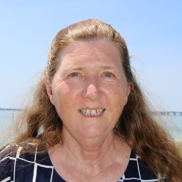
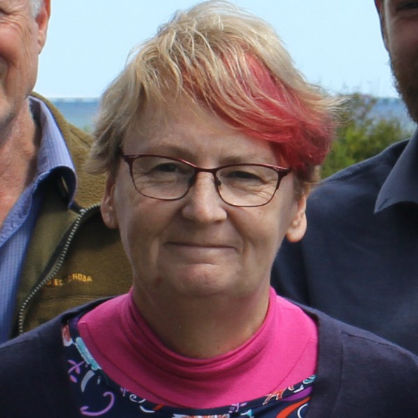
Julie Howes
Deputy Secretary-Treasurer

Julie has lived in Busselton since the ’60s and is well connected within the local community. She has worked for over 20 years in the state government community/public health sector across the South West and now works in aged care. She also facilitates an Aboriginal ladies group.

Andrew Weinert
Community member

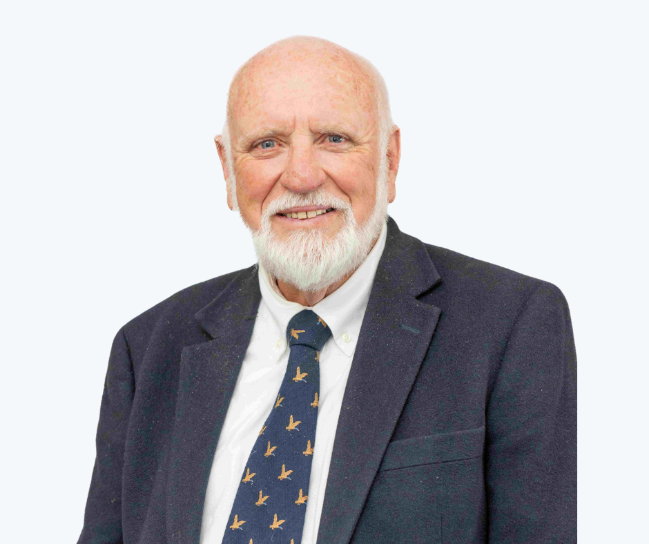
Chair of the Geographe Community Landcare Nursery and President of the WA branch of the Dairy Industry Association of Australia, Andrew has a solid background in agriculture and soil biology. He has worked for the Department of Agriculture and Food and Margaret River Dairy Company, and is now a consultant in the food processing industry.

Jason Ringrose
Water Corporation

Jason lives with his family in Dalyellup. He has worked in diverse leadership roles in Water and Wastewater utilities in the UK and Australia and currently works for Water Corporation. Jason is passionate about sustainability and loves being part of the Collaborative GeoCatch team.

Bev Thurlow
Department of Water and Environmental Regulation

Bev has over 25 years experience in water resource management, including river and estuary management, flood management, land use planning and water allocation planning. She manages the Regional and Technical Service team for the South West.

Tracy Sonneman
Department of Biodiversity, Conservation and Attractions

Tracy moved from the West Kimberley to the South West in recent years to take up a new role at DBCA. She has extensive knowledge and experience in conservation and has co-published a number of research papers.

Leon van Wyk
Department of Primary Industries and Regional Development

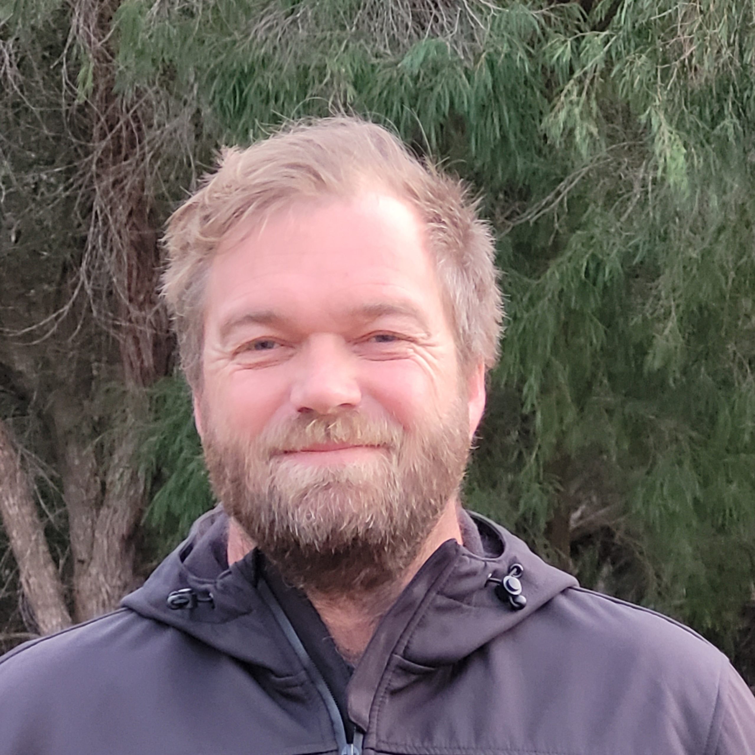
Leon’s work at DPIRD regularly involves environmental issues as he spends a considerable amount of time commenting on land use planning related issues. He is also involved in other projects that aim to improve nutrient management and water use efficiency.

Cr John Fergusson
Shire of Capel

John is a resident of Peppermint Grove Beach and has a varied background in aircraft engineering, metal fabrication and business.
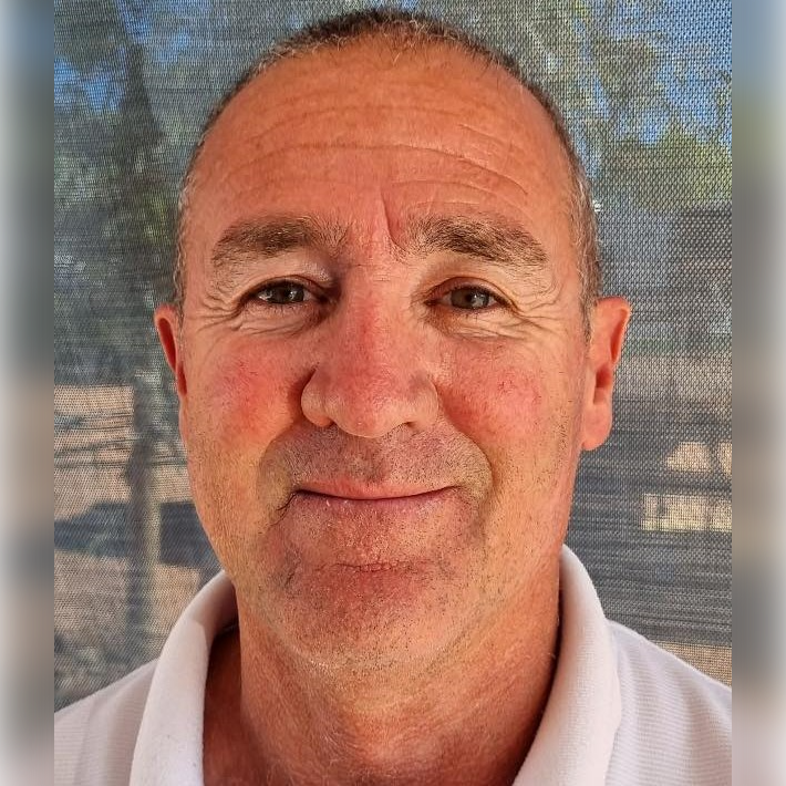
Ross Bromell
Community Member

As well as sitting on the community advisory committee that helped guide the development of the Ngari Capes Marine Park, Ross was the inaugural manager of the Busselton Jetty, and has been a member of the organising committee for the Busselton Jetty Swim since 1999. Currently working in tourism, he has experience in both local and state government.

Steve Pursell
Community Member

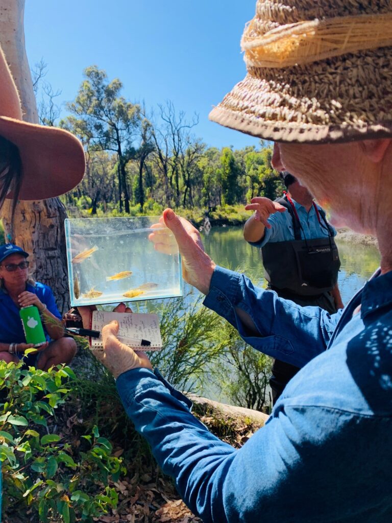
Growing up near the beach in Abbey inspired Steve to study Marine Science and he has recently moved back to Busselton with his young family. Steve had a career in education and now works in natural resource management as Program Manager for OzFish Unlimited in Western Australia. In this role, Steve works with volunteers to deliver projects involving fish, marron and mussel habitat work as well as community seagrass restoration projects.

Annette Batley
Community Member

Annette is a beef farmer who was born and raised in Busselton. She joined the GeoCatch board to share her extensive knowledge and family history of farming in the Geographe Catchment and is excited to learn more about current best management practices for farming operations.

Receive the latest updates

Subscribe To Our Newsletter

Keep in touch with us

Join our Volunteer Register!

Buayanyup

The headwaters of the Buayanyup River occur in state forest where four tributaries flow through native vegetation before flowing through agricultural land. The lower section has been straightened into drainage channels, before flowing into Geographe Bay at Abbey.

The Buayanyup River catchment has a diversity of land uses, including beef and dairy farming, vineyards and horticulture. Native vegetation and timber plantations occur in the south eastern corner of the catchment, and the growing townsite of Vasse occurs in the lower catchment. Nutrients, particularly nitrogen, enter the river from dairy and beef grazing, dairy sheds and horticulture.

Native species, including the Western Minnow, Western Pygmy Perch , Nightfish, Blue-spot Goby, Gilgie, Smooth Marron, Freshwater Shrimp, Koonac and Long neck turtle, have all been found in the river.

Five Mile

Five Mile Brook is a small waterway in the north of the catchment. It flows seasonally to Geographe Bay near Minninup Beach. Five Mile Brook is surrounded by agriculture, particular beef farming, with some urban areas at the south of Dalyellup Estate.

Five Mile Brook has poor water quality. This is due to sandy soil, which does not retain nutrients well, and extensive grazing agriculture in the catchment.

Water sampling by local school groups has found evidence of macroinvertebrates, tadpoles and turtles.

Gynudup

The Gynudup Brook catchment consists of two main tributaries; Tren Creek and Gynudup Brook. The headwaters of Gynudup Brook are in State Forest, which then flow across agricultural land before connecting with the Capel River west of Bussell highway.

The hydrology of the catchment has been extensively modified, containing many artificial drains to alleviate water logging in winter months. Most of the catchment is cleared for agriculture, and the waterways suffer from poor water quality.

Despite being significantly altered, the waterways in the Gynudup catchment provide refuge for several native species including freshwater shrimp, Western Minnow, Blue Spot Goby, Nightfish, Gilgie and the Long-necked Turtle.

Capel

The Capel River is the largest and only perennial river in the Geographe Bay Catchment, receiving groundwater discharge from the Leederville aquifer year-round. Several foreshore reserves of conservation value are situated on the Capel River, including Ironstone Gully Falls.

Land use of the upper Capel River catchment is predominately native vegetation and beef farming. The lower catchment is dominated by beef and dairy farming with pockets of native vegetation and horticulture. The townsites of Capel and Peppermint Grove Beach also occur in the catchment.

The Capel River has relatively good water quality. Carters Freshwater, Smooth Marron, Gilgie, Freshwater Cobbler, Nightfish, Western Pygmy Perch, Western Minnow and Pouched Lamprey can be found in the catchment.

Ludlow

The Ludlow River is the only major waterway to discharge to the Wonnerup Estuary. Its upper catchment lies in the Whicher National Park, after which it flows across the coastal plain through grazing and dairy farmland, horticulture and turf farms.

These land uses contribute nutrients to the river, which suffers from poor water quality. There has been, however, a decreasing trend in nutrient concentrations in the river since 2011.

The Ludlow River retains native aquatic fauna including the Gilgie, Freshwater Shrimp, Nightfish, Western Minnow, Western Pygmy Perch and the Blue Spot Goby.

Abba

The Abba River begins in the Millbrook State Forest, flowing seasonally across the Swan Coastal Plain, through the Ludlow Tuart Forest and eventually into the Vasse Estuary. Landuse in the Abba sub-catchment is predominantly beef and dairy farming, with smaller amounts of sheep farming, vineyards and horticulture.

Ecological surveys of the river have found a diversity of native fish and freshwater crayfish including the Western Minnow, Nightfish, Blue-spot Goby, Western Pygmy Perch, Gilgie and Freshwater Shrimp.

The Abba River is categorised as an ‘intervention’ sub-catchment for water quality, where it meets phosphorus targets, but not nitrogen. Fertiliser for pasture is the largest source of nutrients to the river. We work with landholders and our partners to reduce these nutrients by fencing waterways, fertiliser management and dairy effluent upgrades.

Sabina

The Lower Sabina River flows into the Vasse Estuary. It is separated from its upper catchment, which is diverted into the Vasse Diversion Drain.

The Lower Sabina catchment is small, mostly cleared, with agricultural landuses dominated by dairy and beef farming. The river contributes a significant amount of nutrients to the Vasse-Wonnerup Wetlands.

The river supports Gilgie, Southwest Glass Shrimp, Nightfish, Western Minnow, Western Pygmy Perch and the Blue Spot Goby.

Lower Vasse

The Lower Vasse River flows through the centre of Busselton, extending from the Vasse Diversion Drain at its headwaters, to the Vasse Delta Wetlands at the downstream boundary. The river receives winter flow from the Vasse Diversion Drain through a 900 mm culvert.

The lower catchment is dominated by urban, residential development, while the upper catchment is primarily beef grazing.

The Vasse River suffers from poor water quality and in summer months experiences regular algal blooms. Despite these water quality problems, the Lower Vasse River retains significant ecological values, including a high diversity of fish and native crayfish.

Vasse Diversion

The Vasse Diversion Drain receives water from approximately 60% of the Sabina River catchment and 90% of the Vasse River catchment, diverting flow away from the Vasse-Wonnerup Wetlands and directly into Geographe Bay. These rivers were diverted in the 1920s to protect the Busselton townsite from flooding. The headwaters of these rivers originate in the Whicher Range, then flow across the coastal plain to the diversion drain and eventually to Geographe Bay in West Busselton.

The Vasse Diversion Drain catchment suffers from poor water quality, with phosphorus and nitrogen inputs high. Most nutrients come from the dominant land uses of beef and dairy farming, and smaller amounts from the Busselton wastewater treatment plant.

The upper Vasse and Sabina rivers retain important natural values, including several species of freshwater fish and crayfish. The lower section of the drain near Geographe Bay has important social and recreational value to the community.

Carbunup

The headwaters of the Carbunup River begin on the Whicher Scarp in the Treeton State forest. The river flows in a northerly direction through agricultural land before discharging into Geographe Bay near Siesta Park.

The upper reaches of the river are densely vegetated, however the lower reaches have been cleared and straightened into Lennox River Drain. A weir at the junction of the river and drain prevents saltwater from impacting arable farmland. Due to the dense riparian vegetation and high phosphorus retention index (PRI) of the soil, the Carbunup river has relatively good water quality.

A diverse range of aquatic fauna rely on permanent pools of water that provide refuge over warmer months. Carter’s Freshwater Mussel and Western Pygmy Perch have both been recorded in the river.

Annie

The Annie Brook catchment has three streams – Station Gully, Annie Brook and Mary Brook. These streams begin on the Whicher Scarp and Leeuwin-Naturaliste Ridge, before flowing to the coastal plain where they are artificially straightened into drains that converge at Station Gully before entering Geographe Bay.

The catchment features remnant native vegetation, including some poorly represented vegetation complexes. On the coastal plain, the catchment is mostly cleared for beef farming and smaller amounts of horticulture and viticulture. These land uses contribute nutrients to waterways, particularly nitrogen.

The endangered Dunsborough burrowing crayfish is known to occur in the waterways of the catchment, and surveys have also shown a variety of including the Gilgie, Marron, Nightfish, Western Minnow the Western Pygmy Perch.

Toby Inlet

Toby Inlet is located east of Dunsborough and runs parallel to the coast. It is surrounded by residential areas and is of social and recreational importance to the local community and visitors.

Land use in the wider catchment consists mostly of large rural properties and agriculture. A series of headwaters, originating on the Leeuwin-Naturaliste Ridge, flow across the coastal plain where they become poorly defined. The mouth of the Inlet closes naturally over summer but is opened by the City of Busselton to maintain flushing, as nitrogen levels are currently high.

The Inlet provides habitat for the Swan River Goby, Gilgie and the Dunsborough burrowing crayfish, as well as waterbirds and frogs.

Dunsborough

The Dunsborough streams include Meelup, Dolugup, Dandatup and Dugulup Brooks. Although relatively small and seasonal, the streams are significant to the local community.

They currently maintain good water quality due to their low nitrogen and phosphorus levels. However, the streams are at risk from nutrient runoff primarily from urban and rural-residential sources, including septics, due to their proximity to the Dunsborough townsite.

The streams provide a diversity of habitat and food sources for native fauna and are known to support the Gilgie (Dandatup and Dugulup Brooks), Marron (Meelup Brook) and the Blue Spot Goby (Meelup Brook).

Jingarmup

Jingarmup Brook is a small waterway that flows seasonally across the eastern slopes of the Leeuwin Naturaliste Ridge, through the Eagle Bay townsite to Geographe Bay.

The Jingarmup Brook catchment is categorised as an ‘intervention’ catchment, meeting phosphorus targets but not nitrogen. Native vegetation and beef farming are the dominant land uses in this catchment, which is the southern most region of the Geographe Bay Catchment. 

Water quality is impacted by septics, which contribute a significant amount of the phosphorus load to the waterway, and farming practices. Nitrogen levels are currently high in this waterway. The Meelup Regional Park Management Committee have made significant efforts to restore the riparian zone on lower section of the brook, which supports local biodiversity.